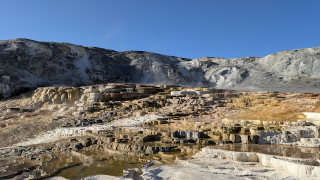
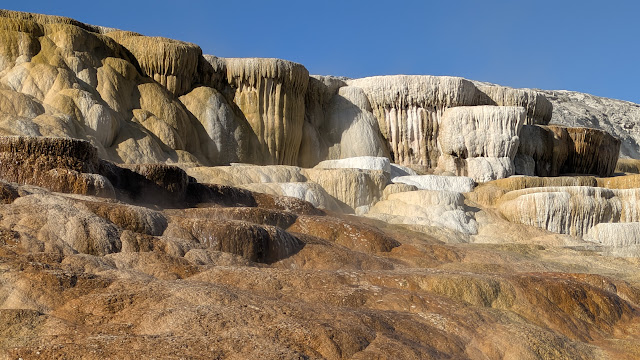
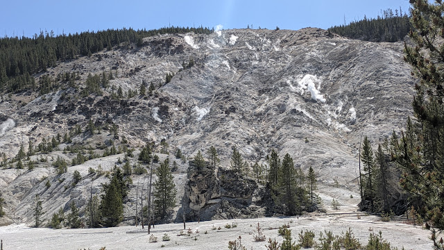
We woke up very early since it was still getting light before 5am. We packed up and left the the campground by 6:45 am. We drove into Yellowstone through the Roosevelt Arch, heading straight to Mammoth Hotsprings, which was the first big feature reached from the North entrance. We spent about an hour touring the area - it really is huge! So many beautiful and other-worldly formations. We easily climbed 150 feet, and we weren't even at the top at that point!
 |
| Beautiful travertine formations made by the flow of hot springs over hundreds and thousands of years. |
Next, we went to the Albright Visitors Center, talked with the rangers and looked at the exhibits about wildlife. We were able to show the ranger our pictures of the coyotes (which we weren't sure if they were wolves or coyotes b/c they were bigger than the coyotes in NC) and she confirmed that they were, in fact, coyotes. She also explained how we could tell the difference if we saw more, plus there was an example in the exhibit hall.
By this time, it was getting to be mid- to late-morning as we started driving south, stopping at the Gibbon Falls and other points, such as Sheepeater Cliff. Sheepeater Cliff is made up of columnar basalt deposited by lava flows roughly 500,000 years ago. The Gardner River flows through the valley, exposing the flow and forming the cliff. The basalt of Sheepeater Cliff are known as columnar basalt due to the hexagonal fracture lines that formed in the basalt when it cooled. The formation is named after a band of Eastern Shoshone Indians, known as the Sheepeaters.
 |
| Sheepeater Cliff |
 |
| Gardiner River |
We came to a major geyser area, Norris Geyser Basin, but it was utter madness!!! So many people, cars, so we decided to wait until late afternoon to attempt it again. We quickly realized that the way to tour the park was to go to the popular places early morning or late afternoon/evening - midday was just too busy for it to be enjoyable.
We decided to have our picnic lunch at a spot called Caldera Rim. After looking at the park map, we realized that it was named this because it is literally within the rim of the supervolcano caldera that sits beneath most of Yellowstone. The mountains that rose up just outside the caldera really brought home the overall depression that the caldera causes over a large swath of YNP.
As we drove to Madison Campground, where we would be camping for the next 3 nights, we kept seeing evidence of the supervolcano underneath us. There were fumaroles (basically steam escaping from the ground), and other features sending up steam everywhere you looked, plus the ever-present smell of rotten eggs! LOL!
Once we both napped and rested for a couple of hours, we decided to do the Firehole River drive, which is a one-way 1 mile drive off of the main road near our campground. We were able to park and found a place to put our feet in the river - there were warm currents you could feel from the hot water that fed in from various hot springs. I had to wade out to the warm spot, but it was definitely there!
We came back to camp, and I made one of our standard camp dinners, Thai chicken curry. We quickly cleaned up the one pot and headed back to Norris Geyser to try touring now that it was after 5 pm. There are 2 major parts of this area. We decided to do the smaller area, given my energy level. We toured the Porcelain Basin part. which featured really beautiful blue-hued pools.
 |
| Overlook of the Porcelain Basin |
 |
| This one was boiling! |


No comments:
Post a Comment